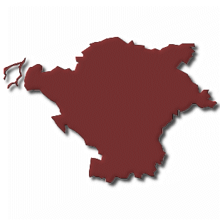
Bayreuth Aichig
Fotos aus dem Umkreis von Bayreuth Aichig
Strassen in der Nähe vom Ortsteil Aichig
- Kemnather Straße (0.08km)
- Uranusstraße (0.12km)
- Sternstraße (0.18km)
- Plutostraße (0.18km)
- Neptunstraße (0.19km)
- Jupiterstraße (0.22km)
- Marsstraße (0.23km)
- Venusstraße (0.25km)
- Wegastraße (0.26km)
- Mostholzstraße (0.27km)
- Sonnenstraße (0.27km)
- Polarstraße (0.3km)
- Frankenwaldstraße (0.33km)
- Orionstraße (0.37km)
- Harzstraße (0.4km)
- Merkurstraße (0.46km)
- Bayerwaldstraße (0.47km)
- Steinwaldstraße (0.49km)
- Saturnstraße (0.54km)
- Mondweg (0.55km)
| Arbeitsmarktdaten von Bayreuth | |
|---|---|
| Sozialversicherungspflichtige | |
| nach Wohnort | 21790 |
| nach Arbeitsort | 39740 |
| Einpendler | 24194 |
| Auspendler | 6244 |
| Geringfügig Beschäftigte (400€ Basis) | |
| nach Wohnort | 6677 |
| nur GeB (Wohnort) | 4498 |
| GeB als Nebenjob (Wohnort) | 2179 |
| nach Arbeitsort | 9423 |
| nur GeB (Arbeitsort) | 6282 |
| GeB als Nebenjob (Arbeitsort) | 3141 |
| Arbeitslose | ca. 76.92% |
| Gesamt | 2806 |
| davon ALG I | 1019 |
| davon HARTZ 4 (ALG II) | 1787 |
| Frauenquote | 44.19% |
| Männerquote | 55.81% |
| Ausländerquote | 14.11% |
| © Arbeitsagentur u.a. | |
| Fakten zur Gemeinde Bayreuth | |
|---|---|
| Gemeindeschlüssel | 09462000 |
| Regionalschlüssel | 094620000000 |
| Gemeindetyp | Kreisfreie Stadt |
| Verwaltung | Stadt Bayreuth Postfach 101052 95444 Bayreuth |
| Bevölkerungsdichte | 1089 Ew. je km² |
| Fläche | 66,97 km² |
| Einwohner | 72935 |
| davon weiblich | 37788 |
| davon männlich | 35147 |
| GPS Latitude | 49.933102 |
| GPS Longitude | 11.622678 |
| Vorwahl | 09201, 09209, 0921 |
| Telefonnetz | Gesees, Emtmannsberg, Bayreuth |
| Land | Bayern |
| Regierungsbezirk | Reg.-Bez. Oberfranken |
| Landkreis | Bayreuth |
| Gemeinde | Bayreuth |
| Aktive Googlemaps-Karte von Bayreuth | |
| Aktive Openstreetmap-Karte von Bayreuth | |
| Steuersätze von Bayreuth | |||
|---|---|---|---|
| Ort | Grundsteuer A | Grundsteuer B | Gewerbesteuerhebesatz |
| Bayreuth | 250 | 400 | 370 |
Gemeinde-Übersichtskarte(n)
Bayreuth, Stadt


