Vlotho Vlotho
Fotos aus dem Umkreis von Vlotho Vlotho
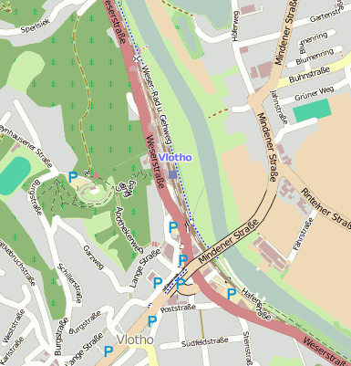
Strassen in der Nähe vom Ortsteil Vlotho
- Weserstraße (0.04km)
- Apothekerweg (0.25km)
- Mindener Straße (0.31km)
- Obergstraße (0.31km)
- Lange Straße (0.33km)
- Zollweg (0.38km)
- Klosterstraße (0.38km)
- In der Grund (0.4km)
- Bismarckstraße (0.41km)
- Garzweg (0.44km)
- Moltkestraße (0.48km)
- Poststraße (0.48km)
- Gutenbergstraße (0.61km)
| Arbeitsmarktdaten von Vlotho, Stadt | |
|---|---|
| Sozialversicherungspflichtige | |
| nach Wohnort | 6720 |
| nach Arbeitsort | 6171 |
| Einpendler | 3881 |
| Auspendler | 4430 |
| Geringfügig Beschäftigte (400€ Basis) | |
| nach Wohnort | 1825 |
| nur GeB (Wohnort) | 1238 |
| GeB als Nebenjob (Wohnort) | 587 |
| nach Arbeitsort | 1501 |
| nur GeB (Arbeitsort) | 1032 |
| GeB als Nebenjob (Arbeitsort) | 469 |
| Arbeitslose | ca. 76.92% |
| Gesamt | 645 |
| davon ALG I | 262 |
| davon HARTZ 4 (ALG II) | 383 |
| Frauenquote | 41.71% |
| Männerquote | 58.29% |
| Ausländerquote | 13.02% |
| © Arbeitsagentur u.a. | |
| Fakten zur Gemeinde Vlotho, Stadt | |
|---|---|
| Gemeindeschlüssel | 05758036 |
| Regionalschlüssel | 057580036036 |
| Gemeindetyp | Stadt |
| Verwaltung | Stadt Vlotho Lange Straße 60 32602 Vlotho |
| Bevölkerungsdichte | 255 Ew. je km² |
| Fläche | 76,93 km² |
| Einwohner | 19634 |
| davon weiblich | 10137 |
| davon männlich | 9497 |
| GPS Latitude | 52.171799 |
| GPS Longitude | 8.864190 |
| Vorwahl | 05221, 05222, 05228, 05706, 05731, 05733 |
| Telefonnetz | Herford, Bad Salzuflen, Vlotho-Exter, Porta Westfalica, Bad Oeynhausen, Vlotho |
| Land | Nordrhein-Westfalen |
| Regierungsbezirk | Reg.-Bez. Detmold |
| Landkreis | Herford |
| Gemeinde | Vlotho, Stadt |
| Aktive Googlemaps-Karte von Vlotho | |
| Aktive Openstreetmap-Karte von Vlotho | |
| Steuersätze von Vlotho, Stadt | |||
|---|---|---|---|
| Ort | Grundsteuer A | Grundsteuer B | Gewerbesteuerhebesatz |
| Vlotho | 215 | 381 | 403 |
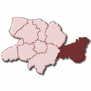
Gemeinde-Übersichtskarte(n)
Vlotho, Stadt


Kartenausschnitt von Yahoo


