Rott am Inn Rott
Der Ortsteil Rott liegt in Rott am Inn und ist dem Postleitzahlgebiet 83543 zugeordnet. Das Zentrum von Rott ist 50,6 km östlich und 64,3 km nördlich vom Zentrum von Rott am Inn entfernt; der Gesamtabstand beträgt 81,86 km.
Ortsteilprofil auf strassenindex.de
strassenindex.de bündelt Ortsteil, Straßen und PLZ mit einem stärkeren Fokus auf Standort- und Immobilienlage.
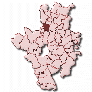
Karte und Lage
Lageprofil für Immobilien
- E-Mobilität: vorhanden Ladepunkte im PLZ-Gebiet nachgewiesen.
- Gesundheit: Traumazentrum regional erreichbar Das nächste Traumazentrum liegt bis 15 km entfernt.
- Schule: Grundschule sehr nah Die nächste Grundschule liegt bis 750 m entfernt.
- Nahversorgung: Supermarkt schnell erreichbar Deutschlandatlas: Pkw-Fahrzeit zum nächsten Supermarkt/Discounter bis 5 Minuten.
Immobilien & WohnungsmarktDigitale Infrastruktur, Energieanlagen, Regionale Kaufkraft
| Digitale Infrastruktur | 89,3 % der Haushalte mit mindestens 1.000 Mbit/s, 89,3 % FTTB/H-Gigabit, 98,5 % 5G-Flächenabdeckung (Gemeinde Rott a. Inn, Festnetz 12/2024, Mobilfunk 01/2025) |
| Energieanlagen | MaStR/BNetzA: 808 aktive Einheiten, 10,3 MW Nettoleistung, Solar 593 / 8,3 MW; Speicher 201 / 1,4 MW; Biomasse 10 / 0,6 MW; Wasser 1 / 0,0 MW; sonstige Erzeugung 3 / 0,0 MW (Gemeinde, Datenstand 18.05.2026) |
| Regionale Kaufkraft | BBSR INKAR: Kaufkraft 30.759 EUR je Einwohner (Gemeinde), Einzelhandelskaufkraft 9.015 EUR je Einwohner (Gemeinde), Steuerkraft 1.244 EUR je Einwohner (Gemeinde) |
| Wohnungsmarkt regional | BBSR INKAR: Angebotsmieten 13,00 EUR/m² (Kreis, 2024), Baulandpreise 717,29 EUR/m² (Kreis, 2022), Baugenehmigungen 2,4 Wohnungen je 1.000 Einwohner (2023) |
| Wohnungsbestand | 1.914 Wohnungen, 1.100 Wohngebäude (Rott a.Inn) |
| Zensus Wohnen | Ø Nettokaltmiete 7,92 €/m², Leerstandsquote 3,5 %, Eigentümerquote 56,0 %, Ø Wohnfläche 112,5 m², 67 leerstehende Wohnungen (Rott a.Inn, Stand 15.05.2022) |
Erreichbarkeit & VersorgungLadeinfrastruktur, Gesundheitsversorgung, Heliport-Umfeld
| Ladeinfrastruktur | 5 Ladepunkte im PLZ-Gebiet, 0 Schnellladeeinrichtungen, bis 44 kW |
| Gesundheitsversorgung | Nächstes Traumazentrum: RoMed Klinik Wasserburg am Inn, lokales Traumazentrum, Wasserburg a.I., 8,2 km |
| Heliport-Umfeld | Nächster BKG-Heliport: Schön Klinik Vogtareuth, Vogtareuth, Hubschrauberlandeplatz, Vogtareuth, 6,4 km |
| Schulen | Grundschule: Grundschule Rott a.Inn (723 m); weiterführend: Mittelschule Rott a.Inn (723 m) (Quelle: Schulferien.cc) |
| Alltagsversorgung | Deutschlandatlas: Supermarkt/Discounter 3,1 Pkw-Min., Notfallversorgung 12,5 Pkw-Min., Hallenbad 14,2 Pkw-Min., Frei-/Naturbad 13,8 Pkw-Min. (Downloadstand 26.06.2025) |
| INKAR-Erreichbarkeit | BBSR INKAR: Autobahnanschluss 25,0 Pkw-Min., IC/ICE-Bahnhof 20,2 Pkw-Min., Hausarzt 651 m, Apotheke 753 m, Grundschule 930 m |
Verkehr, Sicherheit & LärmBundesfernstraßen-Verkehr, Motorisierung, Verkehrssicherheit
| Bundesfernstraßen-Verkehr | Nächste BASt-Dauerzählstelle: Soyen, B 15, 10,7 km, 8.674 Kfz/Tag, 971 Schwerverkehr/Tag, 11,2 % Schwerverkehr (Jahreswert 2023) |
| Motorisierung | 2.935 Pkw, 709 Pkw je 1.000 Einwohner, 4.001 Kraftfahrzeuge insgesamt, 432 Krafträder, 228 Lkw (Rott a.Inn, Stand 01.01.2025) |
| Verkehrssicherheit | 18 erfasste Verkehrsunfälle mit Personenschaden in der Region/Gemeinde 2024 |
| Regionale Sicherheitslage | PKS 2024: 11.082 registrierte Fälle, 4.315 Fälle je 100.000 Einwohner, Aufklärungsquote 78,9 % (Landkreis Rosenheim; Hellfelddaten, nicht straßengenau) |
Natur, Umwelt & KulturKulturumfeld, Schutzgebiete, Schutzgebiete Nähe
| Kulturumfeld | Nächstes BKG/UNESCO-Welterbe: Die Schlösser König Ludwigs II. von Bayern: Neuschwanstein, Linderhof, Schachen und Herrenchiemsee, Neues Schloss Herrenchiemsee, Chiemsee, Kulturstätte, Aufnahme 2025, 24,9 km |
| Schutzgebiete | BfN: 0,2 % Naturschutzgebiet, 8,8 % FFH-Gebiete, 0,2 % Vogelschutzgebiet, 4,3 % Landschaftsschutzgebiete in der Gemeinde (Flächen können sich zwischen Kategorien überlagern) |
| Schutzgebiete Nähe | BfN: nächstes Schutzgebiet zum Gemeindezentrum: Rotter Forst und Rott (FFH-Gebiet, 1,18 km); nächstes strenges Schutzgebiet: Vogelfreistätte Innstausee bei Attel und Freiham (Naturschutzgebiet, 2,53 km); Auswahl: FFH-Gebiet: Innauen und Leitenwälder; Rotter Forst und Rott | Landschaftsschutzgebiet: Schutz des Inntales; Schutz des sog. "Weitfilz" in der Staatswaldunterabteilung I 1f Jägerwald; Schutz von Landschaftsteilen im |
| Flächennutzung | Siedlung 9,2 %, Verkehr 4,4 %, Wald 20,0 %, Landwirtschaft 62,0 %, Gewässer 1,2 %; Wohnbaufläche 78 ha, Industrie/Gewerbe 27 ha (Rott a.Inn, Stand 31.12.2021) |
Wahlen & RegionalprofilBundestagswahl 2025, Zweitstimmenanteile, Wahlkreis-Strukturdaten
| Bundestagswahl 2025 | Bundeswahlleiterin: Wahlkreis 221 Rosenheim, Wahlbeteiligung 84,4 %, stärkste Zweitstimme: CSU 37,6 %, stärkste Erststimme: CSU 40,9 %, Wahlkreisgewinner nach Zweitstimmendeckung: CSU (amtliches Wahlkreisergebnis, kein Straßen- oder Gemeindeergebnis) |
| Zweitstimmenanteile | CSU 37,6 %, SPD 9,6 %, GRÜNE 12,5 %, AfD 19,6 %, Die Linke 5,0 %, FDP 4,7 %, BSW 3,0 %, FREIE WÄHLER 4,7 % im Bundestagswahlkreis 221 |
| Wahlkreis-Strukturdaten | Bundeswahlleiterin: Bevölkerung 321.300, verfügbares Einkommen 26.353 EUR/Ew., Arbeitslosenquote 3,3 %, Pkw 667 je 1.000 Ew. (Stichtage je Strukturmerkmal unterschiedlich) |
Demografie & WirtschaftSozialstruktur regional, Demografie, Altersstruktur
| Sozialstruktur regional | BBSR INKAR: SGB-II-Quote 2,6 % (Kreis), Kinderarmut 4,1 % (Kreis), Altersarmut 1,9 % (Kreis) |
| Demografie | Durchschnittsalter 43,0 Jahre (Rott a.Inn) |
| Altersstruktur | 433 unter 10 Jahre (10,5 %), 822 ab 65 Jahre (19,8 %) (Rott a.Inn, Stand 31.12.2024) |
| Arbeitsmarkt | 1.542 sozialversicherungspflichtig Beschäftigte am Arbeitsort (Rott a.Inn), Stand 30.06.2024 |
| Wanderung | Saldo -26 (224 Zuzüge, 250 Fortzüge) (Rott a.Inn, 2024) |
| Sterbefälle | 30 Sterbefälle (Rott a.Inn, 2024) |
| Zensus 2022 | 4.061 Einwohner (Rott a.Inn, Abweichung zur Fortschreibung -106, Stand 15.05.2022) |
Die vollständigen Quellennachweise, Datenstände und Importdaten stehen auf der Seite Quellennachweise und Datenimporte.
Straßen im Ortsteil Rott
- Aemilian-Öttlinger-Straße (80,95 km)
- Aiblinger Straße (82,87 km)
- Alpenstraße (81,76 km)
- Am Eckfeld (80,70 km)
- Am Eckfeld Süd (80,74 km)
- Am Langacker (81,60 km)
- Am Priel (81,11 km)
- Arnikaweg (81,72 km)
- Asamweg (81,50 km)
- Bahnhofstraße (81,04 km)
- Benedikt-Lutz-Straße (81,02 km)
- Benedikt-Stumpf-Straße (81,08 km)
- Birkenweg (78,12 km)
- Buchenweg (81,15 km)
- Edelweißstraße (81,84 km)
- Enzianstraße (81,74 km)
- Eschenweg (80,72 km)
- Eugen-Roth-Straße (80,22 km)
- Feldweg (81,57 km)
- Gartenweg (81,21 km)
- Gregor-Mack-Straße (81,15 km)
- Haager Straße (81,18 km)
- Hagenrain (81,57 km)
- Heinrich-Varcher-Straße (81,02 km)
- Heubergstraße (81,70 km)
- Hochfellnstraße (81,50 km)
- Hochriesstraße (81,63 km)
- Ignaz-Günther-straße (81,56 km)
- Innstraße (80,93 km)
- Johann-Bauer-Straße (81,03 km)
- Johann-Michael-Fischer-Straße (81,45 km)
- Joseph-Götsch-Straße (81,46 km)
- Kaiserhof (81,54 km)
- Kampenwandstraße (81,56 km)
- Kirchweg (81,35 km)
- Korbinian-Grätz-Straße (81,05 km)
- Kranzhornstraße (81,76 km)
- Krokusweg (81,74 km)
- Latschenweg (81,81 km)
- Leiten (79,64 km)
- Leitenweg (80,71 km)
- Lena-Christ-Weg (80,20 km)
- Lengdorfer Straße (81,46 km)
- Ludwig-Ganghofer-Straße (80,38 km)
- Ludwig-Thoma-Weg (80,47 km)
- Marktplatz (81,51 km)
- Matthäus-Günther-Straße (81,45 km)
- Mitterfeld (81,05 km)
- Münchener Straße (81,49 km)
- Pfarrer-Gruber-Straße (81,35 km)
- Rosenheimer Straße (81,84 km)
- Rottmooser Straße (81,70 km)
- Sägewerk (80,89 km)
- Stögerfeld (81,02 km)
- Voglberg (81,04 km)
- Wasserburger Straße (80,59 km)
- Weinberg (81,73 km)
- Wendelsteinstraße (81,70 km)
| Fakten zur Gemeinde Rott a.Inn | |
|---|---|
| Gemeindeschlüssel | 09187170 |
| Regionalschlüssel | 091875165170 |
| Gemeindetyp | Kreisangehörige Gemeinde |
| Verwaltung | Gemeinde Rott a.Inn Postfach 100 83543 Rott a.Inn |
| Bevölkerungsdichte | 212 Ew. je km² |
| Fläche | 19,57 km² |
| Einwohner | 4.142 |
| davon weiblich | 2.048 |
| davon männlich | 2.094 |
| Breitengrad | 48.436947 |
| Längengrad | 12.992254 |
| Vorwahl | 08039 |
| Telefonnetz | Rott a Inn |
| Land | Bayern |
| Regierungsbezirk | Oberbayern |
| Landkreis | Rosenheim |
| Gemeinde | Rott a.Inn |
| Karte | Karte und Lage |
| Steuersätze in Rott a.Inn | |||
|---|---|---|---|
| Ort | Grundsteuer A | Grundsteuer B | Gewerbesteuerhebesatz |
| Rott a. Inn | 320 | 340 | 350 |
Quelle: Regionaldatenbank Deutschland, Datenstand 31.12.2024. Für rechtsverbindliche Auskünfte gilt die jeweilige Gemeinde bzw. das zuständige Finanzamt.
Kommunale Finanzstruktur
Die Kennzahlen beschreiben die finanzielle und wirtschaftliche Einordnung der Gemeinde. Für Immobilien ist das ein Makrofaktor: höhere Steuerkraft und Kaufkraft können auf einen tragfähigeren Standort hinweisen, Hebesätze zeigen dagegen die kommunale Belastungsseite.
- Gewerbesteuer-Aufkommen2,38 Mio. EUR2023, 575 EUR je Einwohner
- Gewerbesteuer netto2,17 Mio. EUR2023, 525 EUR je Einwohner
- Steuereinnahmekraft6,63 Mio. EUR2023, 1.600 EUR je Einwohner
- Anteil Einkommensteuer3,08 Mio. EUR2023
- Anteil Umsatzsteuer318 Tsd. EUR2023
- Realsteueraufbringungskraft3,43 Mio. EUR2023
- Steuerkraft1.244 EUR je EinwohnerGemeinde, 2023
- Kaufkraft30.759 EUR je EinwohnerGemeinde, 2023
- Einzelhandelskaufkraft9.015 EUR je EinwohnerGemeinde, 2023
- Arbeitsort-Beschäftigte1.542Stand 30.06.2024
- Gewerbesteuer350 % HebesatzRegionaldatenbank 31.12.2024
- Grundsteuer B340 % Hebesatzbebaute/bebaubare Grundstücke
Gewerbesteuer-Aufkommen, Gewerbesteuer netto, Gemeindeanteile und Steuereinnahmekraft stammen aus der Regionaldatenbank Deutschland 71231-01-03-5, Datenstand 31.12.2023. Steuerkraft, Kaufkraft und Einzelhandelskaufkraft stammen aus BBSR INKAR. Hebesätze stammen aus der Regionaldatenbank Deutschland bzw. aktuelleren amtlichen Landes- oder Gemeindedaten.
Übersichtskarten in der Gemeinde