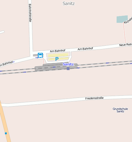
Sanitz (b.Rostock) (Bahnhofsanlage)
Bei(m) Sanitz (b.Rostock) handelt es sich um ein Bahnhofsanlage. Der zugehörige Postleitzahlbereich ist 18190 und gehört somit zum Ort Sanitz .
Gewässer, Gebäude etc. im Umkreis von Sanitz (b.Rostock)
Bahnhofsanlage: Sanitz (b.Rostock) (0km)
Binnensee, Stausee, Teich: Oberhöfer See (1.46km)
Farm / Landwirtschaft: Wehnendorf (2.86km)
Wald, Forst: Kriegholz (2.44km)
Wasserlauf: Steinbach (2.8km)
Geografische Punkte und Wege aus OpenStreetmap in der Nähe von ``Sanitz (b.Rostock)´´
- Fritz-Reuter-Straße
- Friedhofsweg
- John-Brinckman-Straße
- Hof Sanitz
- Groß Lüsewitzer Weg
- Hof Sanitz
- Hof Sanitz
- John-Brinckman-Straße
- Schulsporthalle
- Friedensstraße
- Müllers Wiese
- Friedensstraße
- Am Bahnhof
- Am Bahnhof
- Am Bahnhof
- Am Bahnhof
- Am Bahnhof
- Am Bahnhof
- Am Bahnhof
- Am Bahnhof
- Am Bahnhof
- Am Bahnhof
- John-Brinckman-Straße
- John-Brinckman-Straße
- Kirchsteig
- Feuerlöschteich
- Kirchsteig
- Bahnhofstraße
- John-Brinckman-Straße
- John-Brinckman-Straße
- Kirchsteig
- Rostocker Straße
- Waldweg
- Ribnitzer Straße
- Friedrich-von-Flotow-Ring
- Friedrich-von-Flotow-Ring
- Ribnitzer Straße
- Zum Brunnenhof
- Ribnitzer Straße
- Ribnitzer Straße
- Ernst-Schneller-Straße
- Ernst-Schneller-Straße
- Ernst-Schneller-Straße
- Schulsportplatz
- Sanitz Realschule
- Schlumpfenland
- Frankonia Jagdcenter
- Jagdschule
- Schießhalle Sanitz
- Sanitz
- Weidenapotheke
- Sanitz ZOB
- Kiran
- Salon Anja
- Sanitz
- Parkplatz Verwaltung
- Antalya Döner
- Rathaus Sanitz
- Autoservice Sanitz
Strassen in der Nähe von ``Sanitz (b.Rostock)´´
- Friedensstraße (0km)
- Am Bahnhof (0km)
- John-Brinckman-Straße (0km)
- Müllers Wiese (0km)
- Bahnhofstraße (0km)
- Neue Reihe (0km)
- Hof Sanitz (0km)
- Zum Brunnenhof (0km)
- Friedrich-von-Flotow-Ring (0km)
- Ernst-Schneller-Straße (0km)
- Friedhofsweg (0km)


