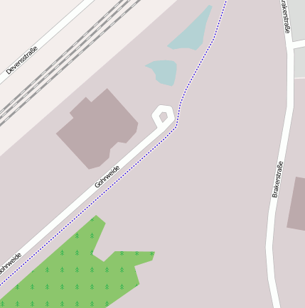
Bahnhof Bottrop Süd (Bahnhofsanlage)
Bei(m) Bahnhof Bottrop Süd handelt es sich um ein Bahnhofsanlage. Der zugehörige Postleitzahlbereich ist 46238 und gehört somit zum Ort Bottrop Batenbrock.
Gewässer, Gebäude etc. im Umkreis von Bahnhof Bottrop Süd
Bahnhofsanlage: Bottrop Süd (0.8km), Bottrop-Boy (2.59km), Haltepunkt Bottrop-Boy (2.18km), Bahnhof Bottrop Süd (0km), Essen-Dellwig (3.79km), Bottrop Hbf (0.57km), Essen-Dellwig Ost (3.63km), Bottrop Nord (3.54km)
Bergbaubetrieb: Bergwerk Prosper-Haniel II (0.76km)
Gebäude: Liebfrauenkirche (3.03km), Herz-Jesu-Kirche (1.4km), Sankt Cyriakus (1.76km)
Hafen: Prosper Hafen (1.85km), Krupp’scher Hafen (2.18km)
Industrie- und Gewerbefläche: Bottrop (1.11km)
Landschaft: Sturmshof (2.18km)
Verkehrsknoten: Bottrop-Süd (1.63km)
Wasserlauf: Aspel-Flotte (2.18km), Vorthbach (3.59km)
Geografische Punkte und Wege aus OpenStreetmap in der Nähe von ``Bahnhof Bottrop Süd´´
- Devensstraße
- Gohrweide
- Am Piekenbrocksbach
- Rubensstraße
- An der Knippenburg
- Ludwig-Richter-Straße
- Glückaufstraße
- Kaulbachstraße
- Brakerstraße
- Kaulbachstraße
- Brakerstraße
- Brakerstraße
- Devensstraße
- Paßstraße
- EGE Döner
- Albrecht-Dürer-Grundschule
- St. Michael
- EKZ Triebe
- Glückaufstraße
- Prosperstraße/Ostring
- Arnsmannstraße
- Prosperstraße/Ostring
Strassen in der Nähe von ``Bahnhof Bottrop Süd´´
- Brakerstraße (0km)
- Glückaufstraße (0km)
- Ludwig-Richter-Straße (0km)
- Devensstraße (0km)
- An der Knippenburg (0km)
- Arenbergstraße (0km)
- Albrecht-Dürer-Straße (0km)
- Kaulbachstraße (0km)
- Am Piekenbrocksbach (0km)
- Gohrweide (0km)
- Morianstraße (0km)
- Rubensstraße (0km)


