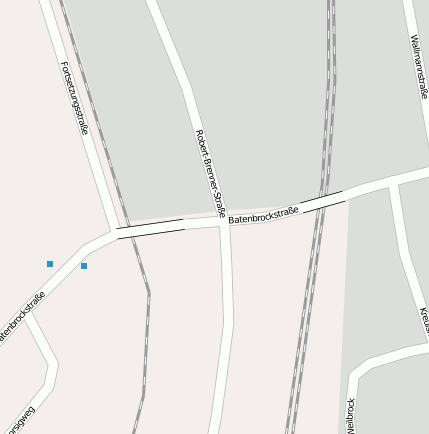
Haltepunkt Bottrop-Boy (Bahnhofsanlage)
Bei(m) Haltepunkt Bottrop-Boy handelt es sich um ein Bahnhofsanlage. Der zugehörige Postleitzahlbereich ist 46240 und gehört somit zum Ort Bottrop Boy.
Gewässer, Gebäude etc. im Umkreis von Haltepunkt Bottrop-Boy
Bahnhofsanlage: Bottrop Hbf (2.71km), Bottrop Süd (2.95km), Bahnhof Bottrop Süd (2.18km), Rheinbaben (1.98km), Haltepunkt Bottrop-Boy (0km), Bottrop-Boy (0.44km)
Bergbaubetrieb: Bergwerk Prosper-Haniel II (1.69km)
Industrie- und Gewerbefläche: Bottrop (2.26km)
Stadion: Stadion Gladbeck - Vestische Kampfbahn (3.39km)
Verkehrsknoten: Bottrop-Süd (3.81km), Gladbeck-Ellinghorst (2.21km), Essen/Gladbeck (2.73km), Kreuz Essen-Nord (3.78km)
Wasserlauf: Boye (2.3km)
Geografische Punkte und Wege aus OpenStreetmap in der Nähe von ``Haltepunkt Bottrop-Boy´´
- Daimlerstraße
- Horster Straße
- Bernsmannsweg
- Fortsetzungsstraße
- Batenbrockstraße
- Robert-Brenner-Straße
- Gutenbergstraße
- Horster Straße
- Batenbrockstraße
- Hebeleckstraße
- Wallmannstraße
- Batenbrockstraße
- Weilbrock
- Kreulshof
- Klosterstraße
- Im Johannestal
- Im Johannestal
- Klosterstraße
- Wallmannstraße
- Batenbrockstraße
- Im Johannestal
- Klosterstraße
- Fortsetzungstraße
- Fortsetzungstraße
- Borsigweg
- Cafe Bernsmann
- Borsigweg
- Boy Bf
- EKZ Triebe
- Boy Bf
- EKZ Triebe
- Bottrop-Boy
- Bottrop-Boy
- Im Johannestal
- Boyer Markt
- Boyer Markt
Strassen in der Nähe von ``Haltepunkt Bottrop-Boy´´
- Robert-Brenner-Straße (0km)
- Batenbrockstraße (0km)
- Fortsetzungstraße (0km)
- Kreulshof (0km)
- Weilbrock (0km)
- Klosterstraße (0km)
- Borsigweg (0km)
- Wallmannstraße (0km)
- Hebeleckstraße (0km)
- Bernsmannweg (0km)
- Daimlerstraße (0km)
- Im Johannestal (0km)
- Gutenbergstraße (0km)
Kartenausschnitt von Yahoo


